Blackbird Detection & Crop Protection
Multimodal AI for Wildlife Management in Agriculture
Overview
Blackbird flocks cause substantial damage to sunflower and other row crops across the Northern Plains every season. This project develops AI-driven detection and classification systems that give farmers and land managers an earlier, more precise picture of flock activity — enabling non-lethal, targeted deterrence rather than broad reactive measures.
The work is a collaboration with wildlife scientists in North Dakota who collect drone-based RGB, thermal (IR), and acoustic recordings directly from active agricultural sites. That real-world data grounds every design decision: the models are built to work under field conditions, not controlled benchmarks.
The Challenge
Detecting birds in drone imagery is harder than it looks. Performance varies sharply with background type: open sky provides clear contrast and yields the best detection results; green vegetation (mid-season canopy) introduces clutter and degrades accuracy; and dry, brownish crop residue is the hardest case — especially for female birds, whose plumage closely matches the soil and stalk color, making them nearly invisible against that background.
The practical implication is that a system calibrated on clean sky-background frames will fail exactly when birds are hardest to see — late in the growing season when camouflage is strongest and crop damage is most consequential.
RGB Approach
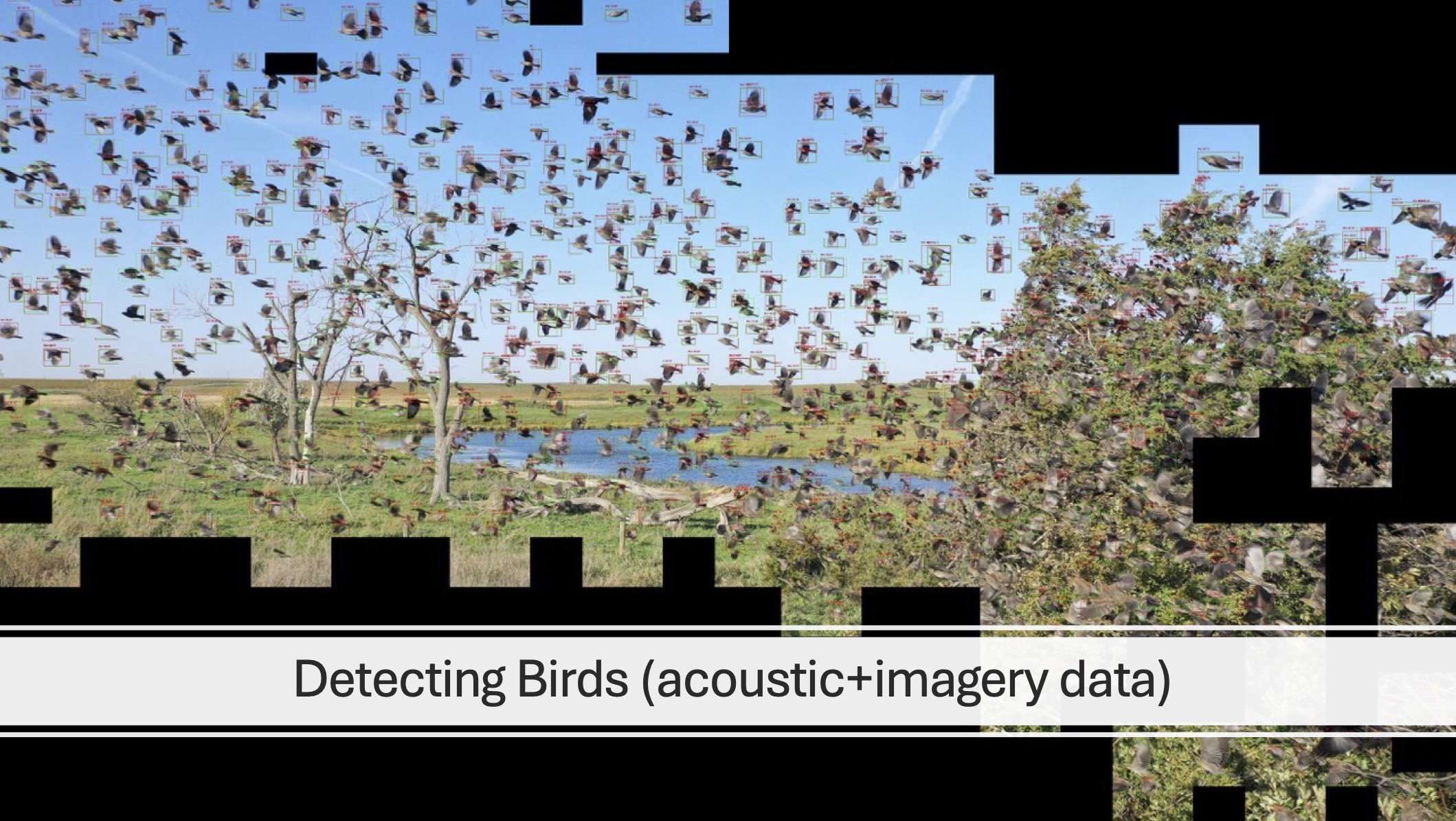
The published system processes drone RGB video by dividing each frame into a grid of tiles, then routing only the tile-level crops through the detection model. This tiling strategy lets the model focus on local image regions at a resolution appropriate for small bird targets, rather than trying to process full high-resolution frames that would dilute the signal.
To address the background challenge, the approach uses color histograms to characterize each tile's background type before detection. Histogram features capture the dominant color distribution of a tile — distinguishing sky, vegetation, and soil — and allow the system to apply background-aware processing that compensates for the varying difficulty levels each background presents.
Beyond RGB
The RGB system establishes a strong baseline, but visual detection alone has fundamental limits — lighting, canopy cover, and camouflage all impose a performance ceiling that no amount of model tuning can fully overcome. Ongoing work explores additional sensing modalities that complement RGB under exactly these conditions, using data collected by the same North Dakota wildlife science teams from active field deployments.
The Vision
The longer-term goal is a unified detection system that draws on multiple sensing sources simultaneously — one that understands the problem broadly enough to remain reliable across the full range of field conditions encountered across a growing season. Work is in progress; results forthcoming.
Annotation
Managing multimodal field data — coordinating annotators across RGB, acoustic, and IR sources — motivated the development of SPECTRA, a general-purpose multimodal annotation and data management platform being built alongside this project.
Publications
- Machine Learning to Detect, Classify, and Count Blackbirds Damaging Agriculture Using Drone-Based Imagery: Supporting AI-Driven Automation for Deployment of Damage Management Tools — 2025
- Know Thy Enemy: Using Drones to Evaluate Composition and Size of Blackbird Flocks Foraging in Commercial Sunflower — 2022