Research Projects: North America-Caribbean Plate Boundary
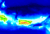
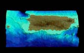
 Puerto Rico Trench: In collaboration with Paul Mann (UT Austin) and James Dolan (U of Southern CA), Nancy Grindlay and UNCW and UT graduate students have used swath bathymetry, sidescan sonar, single-channel seismics, gravity and magnetics data of the Puerto Rico Trench to examine time-transgressive deformational effects of obliquely subducting aseismic ridges on the northern Puerto Rico-Virgin Islands margin. 3-D virtual fly-over of plate boundary (6.4 MB). Puerto Rico Trench: In collaboration with Paul Mann (UT Austin) and James Dolan (U of Southern CA), Nancy Grindlay and UNCW and UT graduate students have used swath bathymetry, sidescan sonar, single-channel seismics, gravity and magnetics data of the Puerto Rico Trench to examine time-transgressive deformational effects of obliquely subducting aseismic ridges on the northern Puerto Rico-Virgin Islands margin. 3-D virtual fly-over of plate boundary (6.4 MB).
Recently, Nancy Grindlay, former graduate student Meghan Hearne and Paul Mann have examined amphitheater-shaped scarps, crescentic cracks, and submarine landslide deposits to determine the potential for tsunami generation along the northern Puerto Rico-Virgin Islands margin. Submarine landslide webpage.
In September 2006, Nancy Grindlay, UNCW graduate students Jennie Mancinone, Steve Mondziel and Kassy Rodriguez, and Willard Moore (U. of South Carolina) conducted a University of Puerto Rico SeaGrant-funded research cruise to investigate the possible linkages between submarine groundwater fluxes and amphitheater-shaped head scarps and cracks in the seafloor offshore northern Puerto Rico.
Currently, graduate student Steve Mondziel, Nancy Grindlay, and Paul Mann are using multi- and single channel seismic data together with multibeam bathymetry and sidescan sonar imagery in a structural analysis of the Mona Rift offshore Northwest Puerto Rico. The study will also assess seismic and tsunami hazards associated with this tectonically active submarine feature.
 Western and Southern Coastal Puerto Rico: Former UNCW graduate student Luke Del Greco, Nancy Grindlay, Lewis Abrams and Paul Mann were funded by the USGS National Hazard Reduction Program to conduct a high-resolution marine geophysical survey offshore western and southern Puerto Rico. The objective of the projects is to identify late Holocene fault activity on the insular shelf of Puerto Rico and relate it with active faults onland. A GIS data base of existing and recently collected seismic and sidescan imagery, and geologic data has been generated. Cruise webpage. Western and Southern Coastal Puerto Rico: Former UNCW graduate student Luke Del Greco, Nancy Grindlay, Lewis Abrams and Paul Mann were funded by the USGS National Hazard Reduction Program to conduct a high-resolution marine geophysical survey offshore western and southern Puerto Rico. The objective of the projects is to identify late Holocene fault activity on the insular shelf of Puerto Rico and relate it with active faults onland. A GIS data base of existing and recently collected seismic and sidescan imagery, and geologic data has been generated. Cruise webpage.
Anegada Passage and Virgin Islands Basin: In March 2007, Nancy Grindlay participated on the Danish research expedition Galathea 3 with marine geologists Holger Lykke Anderson (University of Aarhus) and Antoon Kuijpers (GEUS). During Leg 16 of the expedition scientists onboard the R/V Vaedderen collected cores multibeam bathymetry, multichannel seismics, and gravity data to investigate plate tectonics and earthquakes, hurricanes and ocean circulation changes off the U.S. Virgin Islands.
Research Projects: Southwest Indian Ridge
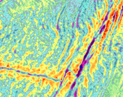
 Nancy Grindlay, John Madsen (U. of Delaware), Celine Rommevaux-Jestin (CNRS-Paris), John Sclater (UC - San Diego) and UDEL and UNCW students have collected multibeam bathymetry, gravity and magnetics over Southwest Indian Ridge (SWIR) from 15°E to 35°E. The objective of this project is to characterize the spatial variability in crustal accretion at very slow spreading rates. Nancy Grindlay, John Madsen (U. of Delaware), Celine Rommevaux-Jestin (CNRS-Paris), John Sclater (UC - San Diego) and UDEL and UNCW students have collected multibeam bathymetry, gravity and magnetics over Southwest Indian Ridge (SWIR) from 15°E to 35°E. The objective of this project is to characterize the spatial variability in crustal accretion at very slow spreading rates.
Nancy Grindlay, John Sclater (UC - San Diego, Scripps), Marco Ligi and Enrico Bonatti (IM-Bologna) conducted a marine geophysical cruise of the Andrew Bain transform fault in Feb.-March 2006. With bathymetry, gravity, magnetics, multi-channel seismics and rock samples, they will be investigating of the effects of cold, thick lithosphere on deformation of slowly slipping mega-transforms. Cruise Report
Research Projects: Western Pacific Ocean
 Lewis Abrams is using geophysical and tectonic studies related to coring and logging results obtained from Hole 801C and Site 1149 on Ocean Drilling Program Leg 185. Lewis Abrams is using geophysical and tectonic studies related to coring and logging results obtained from Hole 801C and Site 1149 on Ocean Drilling Program Leg 185.
Former graduate student Michael Murphy and Lewis Abrams used reflection and refraction data collected with the Japanese research vessel Hakuho Maru to investigate the tectonic and volcanic history of the Nauru basin, western Pacific.
Research Projects: Coastal Southeast US
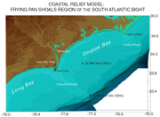
 Nancy Grindlay and former graduate students Matt Head and Jeffery Marshall are using high-resolution sidescan sonar to classify the seabed and monitor event-driven sediment dynamics on the inner and mid- continental shelf Onslow Bay, NC. This research is part of UNCW's Coastal Ocean Research and Monitoring Project. Nancy Grindlay and former graduate students Matt Head and Jeffery Marshall are using high-resolution sidescan sonar to classify the seabed and monitor event-driven sediment dynamics on the inner and mid- continental shelf Onslow Bay, NC. This research is part of UNCW's Coastal Ocean Research and Monitoring Project.
Most recently, Nancy Grindlay, Lewis Abrams, Troy Alphin (UNCW-biology) and graduate student Kassy Rodriguez have been funded by the Center for Marine Science to use high-resolution seismics and sidescan sonar to locate historic and ancient oyster beds in the lower Cape Fear River. Success of this project will help with shellfish restoration in the region.
Currently, graduate student Amanda Maness, Nancy Grindlay and Andy Shepard of the National Undersea Research Center (NURC) are using high-resolution multibeam bathymetry and backscatter data to classify the seabed habitat and to monitor the Oculina Habitat Area of Concern offshore eastern Flordia.
Research Projects: Tambora Volcano, Sumbawa, Indonesia
 Lewis Abrams, Haraldur Sigurdsson (URI-GSO), and Igan Sutawidjaja (DVGHM) have recently conducted a ground-penetrating radar investigation of villages buried by pyroclastic flows associated with the 1815 eruption of Tambora volcano, the largest eruption in recorded history. Results of the this study will be presented in a Discovery Channel special "The Year without Summer" first broadcast in 2005. Lewis Abrams, Haraldur Sigurdsson (URI-GSO), and Igan Sutawidjaja (DVGHM) have recently conducted a ground-penetrating radar investigation of villages buried by pyroclastic flows associated with the 1815 eruption of Tambora volcano, the largest eruption in recorded history. Results of the this study will be presented in a Discovery Channel special "The Year without Summer" first broadcast in 2005.
Research Projects: Endeavor Deep, Juan Fernandez Microplate, SE Pacific Ocean
 Lewis Abrams and undergraduate Honors student Chris Wood participated on a 32-day research cruise to the Endeavor Deep. Using a high-resolution sidescan sonar (DSL-120), mini autonomous plume recorders (MAPRs) and the remotely operated vehicle Jason II, Lewis and Chris identified hydrothermal vents in this propagating rift environment. Cruise webpage. Lewis Abrams and undergraduate Honors student Chris Wood participated on a 32-day research cruise to the Endeavor Deep. Using a high-resolution sidescan sonar (DSL-120), mini autonomous plume recorders (MAPRs) and the remotely operated vehicle Jason II, Lewis and Chris identified hydrothermal vents in this propagating rift environment. Cruise webpage.
Research Projects: Tongareva Triple Junction, Southwest Pacific Ocean
In collaboration with Robert Pockalny and Roger Larson (URI-GSO), Lewis Abrams collected swath bathymetry, gravity and magnetics data over the trace of the Tongareva Triple Junction. The objective of this cruise was to determine the tectonic history of the south Pacific within the Cretaceous Magnetic Quiet Zone post the Manahiki Plateau eruption. Cruise webpage.
|
