Groundwater in the Desert
 |
 |
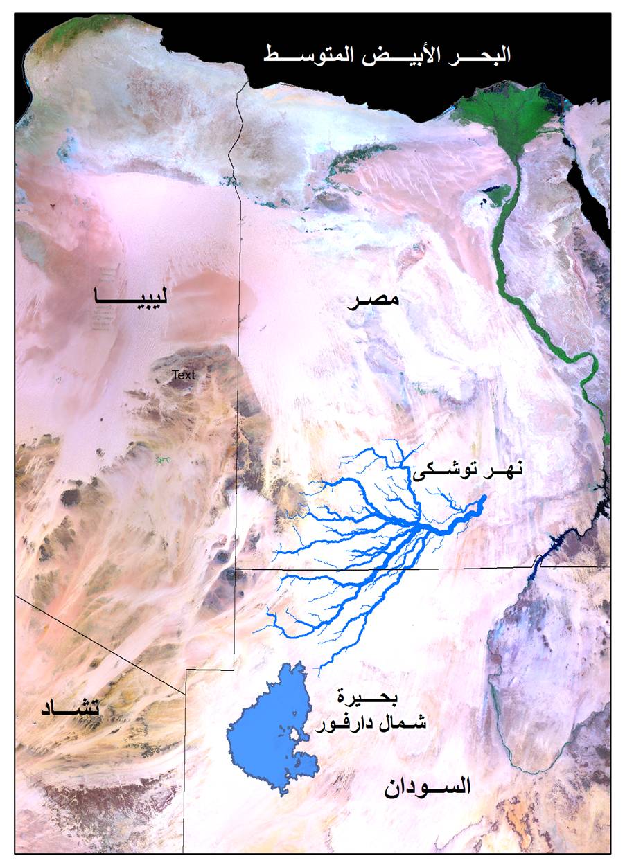
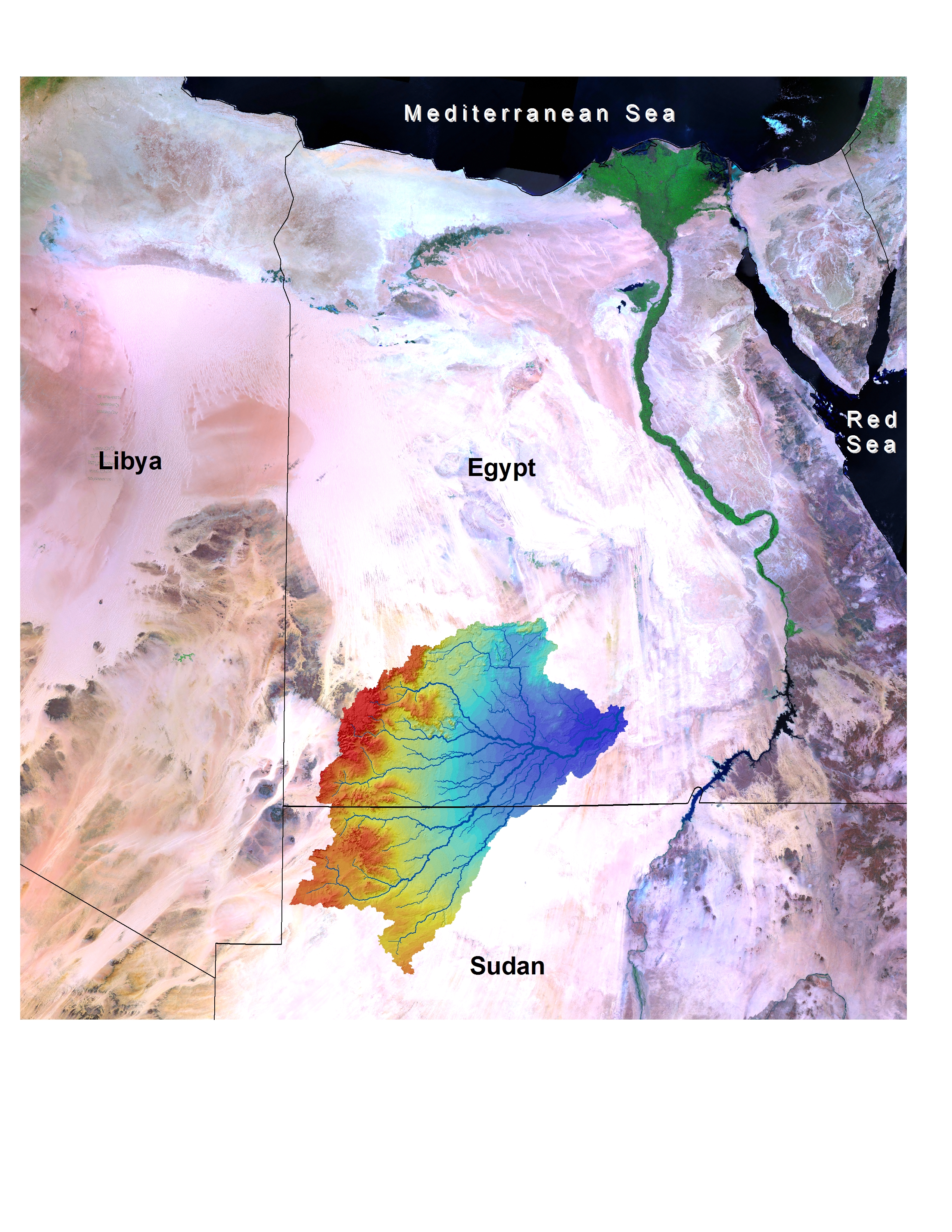
The recently available Shuttle Radar Topography Mission (SRTM) data, with 90 m horizontal resolution, are used to delineate the entire Tushka mega-watershed. It is calculated that the watershed covers an area of 150 000 km2 and composed of four subwatersheds. This study indicates that the Tushka basin is a closed hydrological system independent of the Nile hydro-system, the Qena Valley system, and the Chad basin as well.

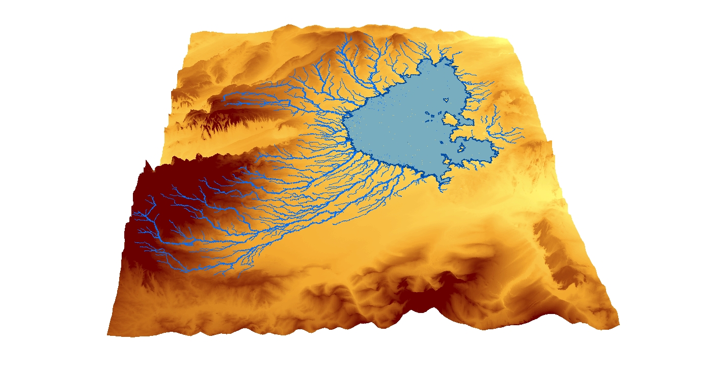
North-western Sudan, as a part of the eastern Sahara, is among the driest places on earth. However, the region underwent drastic climatic changes through the alternation of dry and wet conditions in the past. During humid phases, when the rain was plentiful over a prolonged time period, the surface was veined by rivers and dotted by large lakes. The new Shuttle Radar Topography Mission data revealed a large endorheic drainage basin, which is centred by a large terminal palaeolake, in the northern Darfur State. The use of GIS methods allowed the delineation of the drainage basin and its associated palaeorivers.
