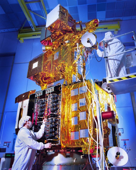

Full face view of Earth as taken from just above the Moon by the Clementine satellite.

The Landsat Program is a series of Earth-observing satellite missions jointly managed by NASA and the U.S. Geological Survey. Since 1972, Landsat satellites have collected information about Earth from space. This science, known as remote sensing, has matured with the Landsat Program.

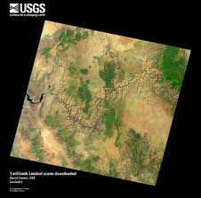
An example of an image taken by LandSat. The public has free access to this imagery at glovis.usgs.gov.

LIDAR, which stands for Light Detection And Ranging is a useful technique that can created 3-dimensional imagery for elevation. North Carolina has it's entire state digitized through LiDAR. The public has free access to the data: NCDOT.

RADAR can be used to interpolate rainfall data from storm systems, such as a hurricane. This can be used in developing models for predicting the outcomes and determining the amount of damage caused.
Why Remote Sensing?
Scientists of many disciplines are accustomed to studying data that cannot be observed through direct contact. Physicists and chemists, for instance, know a great deal about the structure of the atom, even though even the most high-powered microscope cannot make an atom visible to the human eye. The objects of study for earth scientists are often similarly remote, though not necessarily because they are small. In some cases, the problem is quite the opposite: an area selected for study is too large to provide understanding to geologists working only on the ground. Other areas are simply inaccessible to human beings or even their equipment. This has necessitated the development of remote sensing equipment and techniques, primarily involving views from the air or from space and utilizing electromagnetic radiation across a wide spectrum.
What is Remote Sensing?
There are two main types of remote sensing: passive remote sensing and active remote sensing. Passive sensors detect natural radiation that is emitted or reflected by the object or surrounding area being observed. Reflected sunlight is the most common source of radiation measured by passive sensors. Examples of passive remote sensors include film photography, infrared, charge-coupled devices, and radiometers. Active collection, on the other hand, emits energy in order to scan objects and areas whereupon a sensor then detects and measures the radiation that is reflected or backscattered from the target. RADAR is an example of active remote sensing where the time delay between emission and return is measured, establishing the location, height, speed and direction of an object.
Remote sensing makes it possible to collect data on dangerous or inaccessible areas. Remote sensing applications include monitoring deforestation in areas such as the Amazon Basin, glacial features in Arctic and Antarctic regions, and depth sounding of coastal and ocean depths. Military collection during the cold war made use of stand-off collection of data about dangerous border areas. Remote sensing also replaces costly and slow data collection on the ground, ensuring in the process that areas or objects are not disturbed.
Orbital platforms collect and transmit data from different parts of the electromagnetic spectrum, which in conjunction with larger scale aerial or ground-based sensing and analysis, provides researchers with enough information to monitor trends such as El Niño and other natural long and short term phenomena. Other uses include different areas of the earth sciences such as natural resource management, agricultural fields such as land usage and conservation, and national security and overhead, ground-based and stand-off collection on border areas.
By satellite, aircraft, spacecraft, buoy, ship, and helicopter images, data is created to analyze and compare things like vegetation rates, erosion, pollution, forestry, weather, and land use. These things can be mapped, imaged, tracked and observed. The process of remote sensing is also helpful for city planning, archaeological investigations, military observation and geomorphological surveying.
Where does Remote Sensing data come from?
-
Conventional radar is mostly associated with aerial traffic control, early warning, and certain large scale meteorological data. Doppler radar is
used by local law enforcements' monitoring of speed limits and in enhanced meteorological collection such as wind speed and direction within weather
systems. Other types of active collection includes plasmas in the ionosphere. Interferometric synthetic aperture radar is used to produce precise
digital elevation models of large scale terrain. Some organizations that utilize this type of imagery and data are NOAA for hurricane tracking (GOES Satellite) and NASA/JAXA for weather modeling (TRMM).
-
Laser and radar altimeters on satellites have provided a wide range of data. By measuring the bulges of water caused by gravity, they map features
on the seafloor to a resolution of a mile or so. By measuring the height and wave-length of ocean waves, the altimeters measure wind speeds and
direction, and surface ocean currents and directions.
-
Light detection and ranging (LIDAR) is well known in examples of weapon ranging, laser illuminated homing of projectiles. LIDAR is used to detect
and measure the concentration of various chemicals in the atmosphere, while airborne LIDAR can be used to measure heights of objects and features
on the ground more accurately than with radar technology. Vegetation remote sensing is a principal application of LIDAR. The USGS has also been employing
the use of LIDAR for building 3-dimensional models of terrain for hydrological modeling. They have various bits of information on their website.
-
Radiometers and photometers are the most common instrument in use, collecting reflected and emitted radiation in a wide range of frequencies. The
most common are visible and infrared sensors, followed by microwave, gamma ray and rarely, ultraviolet. They may also be used to detect the emission
spectra of various chemicals, providing data on chemical concentrations in the atmosphere.
-
Stereographic pairs of aerial photographs have often been used to make topographic maps by imagery and terrain analysts in trafficability and highway
departments for potential routes.
-
Simultaneous multi-spectral platforms such as Landsat have been in use since the 70's. These thematic mappers take images in multiple wavelengths of
electro-magnetic radiation (multi-spectral) and are usually found on Earth observation satellites, including (for example) the Landsat program or the
IKONOS satellite. Maps of land cover and land use from thematic mapping can be used to prospect for minerals, detect or monitor land usage, deforestation,
and examine the health of indigenous plants and crops, including entire farming regions or forests. One of the most popular resources is LandSat, which was
launched in 1972. It has a larget breadth of data available here. Another popular multi-spectral
satellite is ASTER, which stands for Advanced Spaceborne Thermal Emission and Reflection Radiometer. The primary differenct between ASTER and LandSat is the number of
bands. ASTER has more available bands, which can increase the amount of analysis performed. However, not all of the data attained by ASTER is free. For more
information, visit the ASTER website
-
Hyperspectral imaging produces an image where each pixel has full spectral information with imaging narrow spectral bands over a contiguous spectral
range. Hyperspectral imagers are used in various applications including mineralogy, biology, defence, and environmental measurements.
-
Within the scope of the combat against desertification, remote sensing allows to follow-up and monitor risk areas in the long term, to determine
desertification factors, to support decision-makers in defining relevant measures of environmental management, and to assess their impacts.
